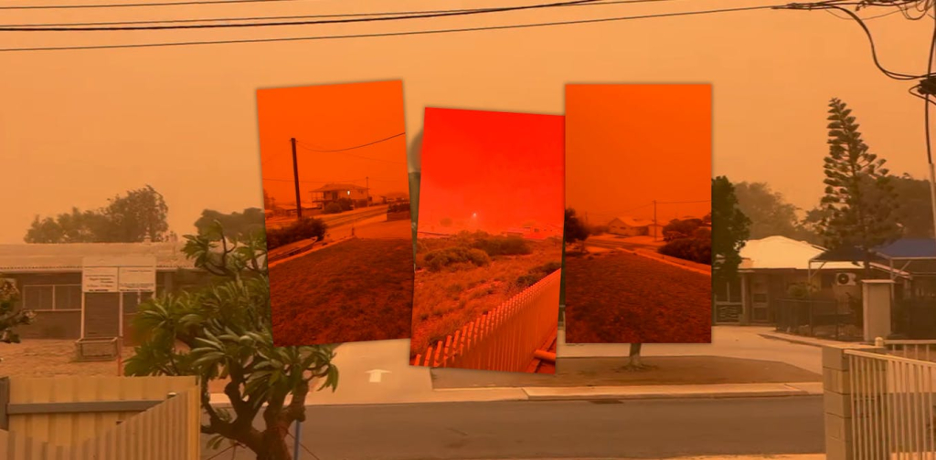

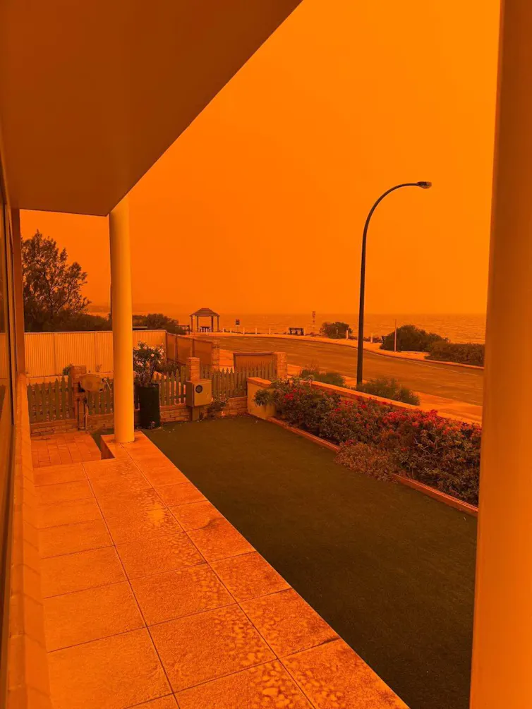
The apocalyptic red skies in Western Australia have generated considerable international media attention. Crimson dust whipped up by the strong outer winds of Severe Tropical Cyclone Narelle created this unusual phenomenon.
Spectacular weather events like this are not common in northwest Australia. They occur under very specific environmental conditions. Most of the tropical cyclones hitting this arid region don’t cause red skies. Mega dust storms which do change the colour of the sky often take place during prolonged droughts. Perhaps the most memorable storm traversed over Melbourne on 8 February 1983, turning the sky red-brown and later pitch black.


So what caused Cyclone Narelle’s dust storm and why was the sky so vividly red? Four factors came together to create these conditions: a very dry and exposed landscape with red soils, a lack of preceding rain, very strong winds ahead of the rain bands from the cyclone, and a particular wind direction.
Why was the dust storm so spectacular?
Australia’s northwest is one of just a few places in the world where tropical cyclones affect an otherwise arid desert climate. Other locations include the Arabian Peninsula and semi-arid parts of India and Pakistan. These dry regions have very little natural vegetation to protect fragile soils from cyclonic winds. In the northwest of WA, the iron-rich soils which attract many big mining companies also give the region its exceptional red appearance.
According to the Bureau of Meteorology, in the six weeks prior to Cyclone Narelle, the greater northwest region had experienced 10-50 mm of rainfall and the barren landscape was very dry. This was a crucial factor behind the size and magnitude of the red-tinged dust storm.
In the Southern Hemisphere, tropical cyclones rotate in a clockwise direction due to the “Coriolis Force”, which applies movement on rotating objects. This explains how the dust storm developed. Strong winds to the south of the cyclone’s eye were coming from the northeast to southeast direction, and hence off the dry landscape.
After tracking in a southerly direction, close to the North West Cape of WA, Narelle eventually crossed the coast near Coral Bay and headed inland, where it weakened.
Narelle’s large area of gale-force winds extended 200-260 kilometres from the centre. These very strong winds in the southwest area of the cyclone blew across the dry Pilbara landscape, picking up fine red sediments ahead of the bands of rain and transporting them westwards. These blood-red dust storms hit coastal towns in the Gasgoyne and Pilbara regions.
The large, flat terrain of the Pilbara would also have created a long wind “fetch” (the distance the wind blows over open terrain). This would have picked up greater numbers of dust particles.
As the cyclone moved through, humidity increased rapidly, followed by dense cloud and finally heavy rain. This is why the apocalyptic dust was short lived – it was washed out of the atmosphere and back to earth.
Why was the sky so red?
The Pilbara’s deep red soils are rich in iron oxides. These soils form the basis of the multi-billion dollar iron ore mining industry.
Understanding the physics of the atmosphere is important. Airborne dust particles scatter shorter wavelengths (blue and green light) more effectively. Longer wavelengths (red and orange light) pass through or dominate what reaches your eyes. The red soil particles made the light an even deeper shade of red. Hence, the sky appeared deep orange red, or even blood coloured.
Due to the right mix of environmental conditions, the Narelle dust storm involved a very high dust concentration, thick enough to significantly filter and tint all incoming sunlight. This created the Mars-like or “apocalyptic” appearance. Cyclone Narelle also approached the North West Cape in the early morning, when sunlight has to travel through more atmosphere. This meant more scattering occurred and made the red tones even stronger.
Mega dust storms are a regular feature during prolonged droughts in central, southern and eastern Australia. A striking example was the “Red Dawn” dust storm in Sydney on 23 September 2009. Residents woke to an eerie red dawn due to a huge dust cloud.
Huge dust storms like this are usually produced by strong cold fronts and severe thunderstorms that force fine sediment particles up into the atmosphere. These particles are typically moved towards the east, even making their way into the upper levels of the troposphere. Occasionally the dust is deposited as far away as the Southern Alps of Aotearoa/New Zealand.
Spectacular weather events such as this stand out on the global stage. A rare combination of the Pilbara’s exceptionally red soils, cyclonic winds from the right direction and perfect pre-rain timing allowed atmospheric dust to build to very high concentrations. Certainly a feast for the eyes and record books.


Comments are closed.