


Morocco spent most of the last decade drying out. Between 2019 and 2024, the country recorded six consecutive years of below-average rainfall, the longest on record. The 2023-24 hydrological year was the driest in more than six decades, with a national total of just 106.4 mm.
But this was not simply another dry spell. The problem went far beyond rainfall. The squeeze was structural as much as meteorological: per-capita renewable water availability has fallen to about 620 cubic metres a year, exacerbating water stress, while three decades of overuse significantly reduced water levels in several aquifers. Nothing about the autumn of 2025 suggested that was about to change.



Then came the winter of 2025–26.
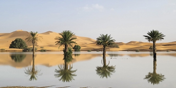
The rain returned suddenly, and on a scale Morocco had not seen in a generation. Seven years of drought ended in a single winter. Severely depleted reservoirs began filling rapidly. Rivers that had run dry started flowing again.
Now, a record-breaking El Niño is developing in the Pacific. Could it send northwestern Africa back into drought? Analysis by my colleagues and me suggests otherwise. The answer lies thousands of kilometres away, over the North Atlantic.
What changed?
Most of Morocco’s rain arrives in winter, carried by Atlantic storms. How many of them reach the country depends in part on the North Atlantic Oscillation, the pressure difference between the Azores and Iceland which sets the speed and position of the jet stream, the high-altitude current that acts like a highway for weather systems.
When that pressure difference is big, the jet stream tends to run faster and farther north, carrying storms toward northern Europe. When it weakens, the jet stream can shift southward. That is essentially what happened through the winter of 2025–26.
Pressure fell around the Azores and rose near Iceland, and the jet stream responded by meandering deep into the subtropics. Its fastest core shifted toward the Moroccan coast rather than remaining farther north toward the British Isles. We identified this combination as a distinctive weather pattern for northwestern Africa: a weakened pressure gradient, a southward-displaced jet stream and Atlantic storms repeatedly reaching Morocco.
That redirected the storm track toward Morocco. One storm after another arrived from the Atlantic, bringing moist air and more rain to already wet ground. The Rif and Atlas mountains pushed this moist air upward, producing even heavier rainfall, particularly over the Sebou basin in the country’s northeast.

What could a super El Niño mean?
The tropical Pacific is undergoing a dramatic shift toward a super El Niño. The U.S. National Oceanic and Atmospheric Administration now puts the odds of a very strong El Niño this winter above 90 per cent, with most models pointing toward an exceptionally strong event. That immediately raises a couple of important questions for Morocco.
Does a super El Niño mean another wet winter? Or could drought return?
We cannot say yet. The reason is that El Niño is only one part of the story. The Pacific Ocean can influence the odds. But for Morocco, the North Atlantic may ultimately determine where the storms go.
Strong El Niño winters tend to push the North Atlantic Oscillation toward its negative phase late in the season, which can shift Atlantic storms farther south. Wetter early winters over Iberia have also been linked to El Niño.
If those pieces fall into place this winter, the Azores-Iceland pressure gradient could weaken again. The jet stream could shift southward, allowing more Atlantic storms to reach Morocco and other parts of northwestern Africa. In other words, a strong El Niño could increase the chances of another wet winter. But there is a catch.
Effects in the North Atlantic

The Atlantic may not follow the Pacific. El Niño does not control the North Atlantic like an on–off switch. The Pacific’s signal reaches Europe indirectly and inconsistently, and it competes with the North Atlantic’s own powerful internal variability.
This helps explain why decades of research has struggled to identify a simple and reliable El Niño fingerprint over the Mediterranean. Our analysis of the winter of 2025–26 illustrates this uncertainty particularly well. Despite the dramatic shift in atmospheric circulation that brought rain back to Morocco, the Pacific and the North Atlantic Oscillation were effectively unrelated. That indicates the wet winter was driven primarily by what was happening over the North Atlantic, rather than by a clear signal coming from the tropical Pacific.
And the rule book keeps changing. El Niño’s grip on North African rainfall appears to have tightened since 2000 as the two oceans fell into step, but that coupling has drifted in and out of phase for as long as we have measured it.
A relationship that shifts across decades makes a poor guide to a single winter. The 2023–24 El Niño provides a useful warning. During that strong event, forecasters expected the North Atlantic Oscillation to shift into its negative phase. It never did.
So, could northwestern Africa slide back into drought? Yes, but not simply because of El Niño.
After seven years of drought and one extraordinary wet winter, northwestern Africa now faces another season of uncertainty. El Niño may change the odds, but it does not decide the outcome. El Niño might load the dice but the North Atlantic throws them.























Comments are closed.